
Size of this preview: 677 × 600 pixels. Other resolutions: 271 × 240 pixels | 700 × 620 pixels.
Original file (700 × 620 pixels, file size: 231 KB, MIME type: image/png)
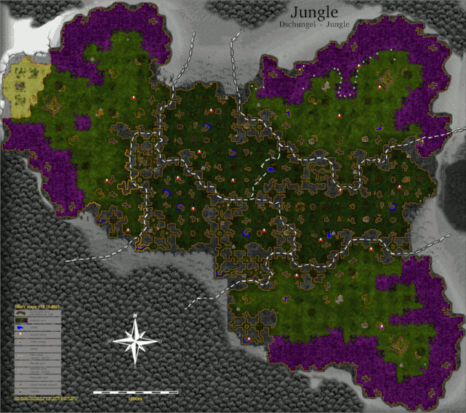
Map of the Zorai region as found in Elke's map collection. Preview version of 1200px height
| Description |
Enhanced map of the Witherings |
|---|---|
| Date |
2021/04/08 |
| Source | |
| Author | |
| Permission |
[CC-BY-SA / LGPLv3] |
Licensing

- 🇩🇪 — Dieses Werk ist lizenziert unter einer Creative Commons Namensnennung - Weitergabe unter gleichen Bedingungen 4.0 International Lizenz.
- 🇬🇧 — This work is licensed under a " Creative Commons Attribution-ShareAlike 4.0 International License.
- 🇪🇸 — Esta obra está bajo una Licencia Creative Commons Atribución-CompartirIgual 4.0 Internacional.
- 🇫🇷 — Cette œuvre est mise à disposition selon les termes de la Licence Creative Commons Attribution - Partage dans les Mêmes Conditions 4.0 Internationale.
- 🇷🇺 — Это произведение доступно по лицензии Creative Commons «Attribution-ShareAlike» («Атрибуция-СохранениеУсловий») 4.0 Всемирная.
You are free:
- to share: to copy, distribute and transmit the work,
- to remix: to adapt the work;
Under the following conditions:
- attribution: You must attribute the work in the manner specified by the author or licensor (but not in any way that suggests that they endorse you or your use of the work).
- share alike: If you alter, transform, or build upon this work, you may distribute the resulting work only under the same, similar, or a compatible license.
File history
Click on a date/time to view the file as it appeared at that time.
| Date/Time | Thumbnail | Dimensions | User | Comment | |
|---|---|---|---|---|---|
| current | 23:02, 22 January 2022 | | 700 × 620 (231 KB) | Elke (talk | contribs) | |
| 16:04, 10 April 2021 | 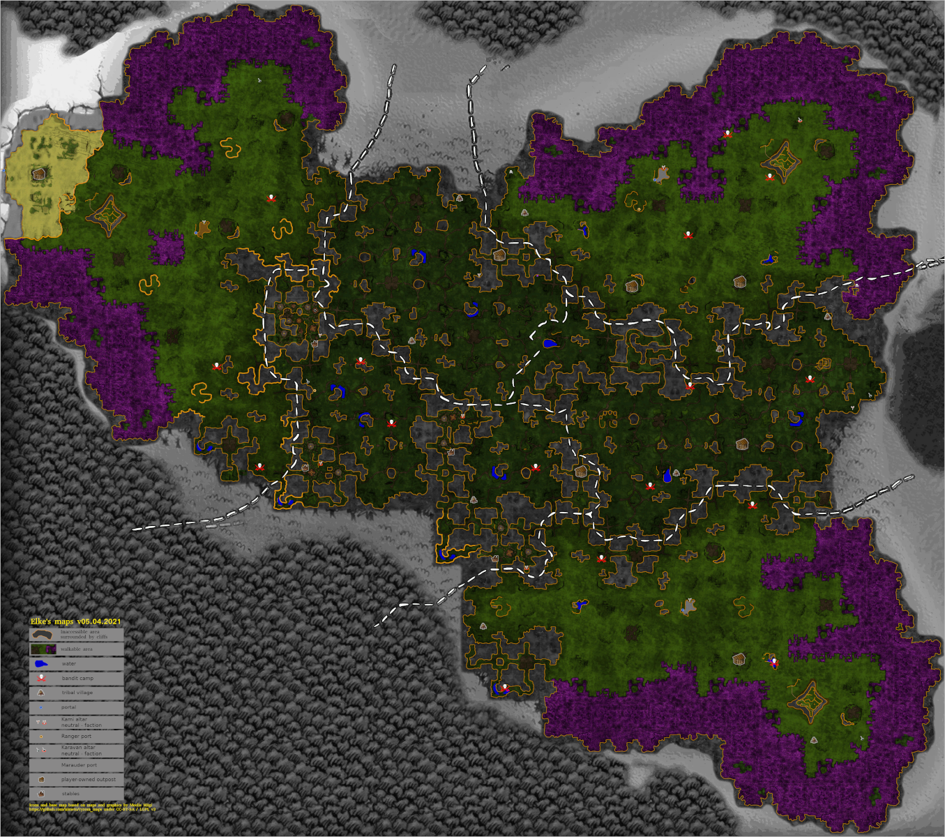 | 1,355 × 1,200 (2.61 MB) | Elke (talk | contribs) | Map of the Zorai region as found in Elke's map collection. Preview version of 1200px height |
- You cannot overwrite this file.
File usage
There are no pages that link to this file.