m |
m |
||
| Line 1: | Line 1: | ||
FR carte de la ville d'Avalae | FR carte de la ville d'Avalae | ||
[[Category:Town maps]][[Category:FR Map images]] | [[Category:Town maps]][[Category:FR Map images]] | ||
| − | |||
Revision as of 02:07, 23 November 2020
FR carte de la ville d'Avalae
File history
Click on a date/time to view the file as it appeared at that time.
| Date/Time | Thumbnail | Dimensions | User | Comment | |
|---|---|---|---|---|---|
| current | 15:49, 24 June 2020 | 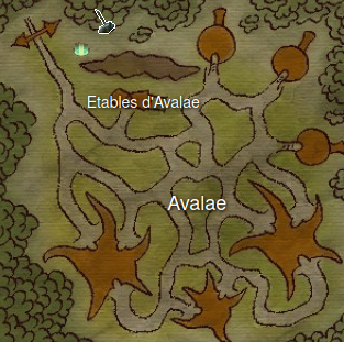 | 313 × 311 (209 KB) | Craftjenn (talk | contribs) | FR carte de la ville d'Avalae Category:Town maps Category:Verdant Heights |
- You cannot overwrite this file.
File usage
The following page links to this file: