
Size of this preview: 600 × 600 pixels. Other resolutions: 240 × 240 pixels | 1,770 × 1,770 pixels.
Original file (1,770 × 1,770 pixels, file size: 6.31 MB, MIME type: image/png)
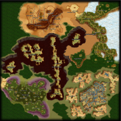
Atys map with region labels (en)
File history
Click on a date/time to view the file as it appeared at that time.
| Date/Time | Thumbnail | Dimensions | User | Comment | |
|---|---|---|---|---|---|
| current | 14:00, 29 February 2020 | | 1,770 × 1,770 (6.31 MB) | Dorothée (talk | contribs) | Atys map with region labels (en) Category:Map images |
- You cannot overwrite this file.
File usage
There are no pages that link to this file.